Saturday, June 9, 2012

Lone Tree Point, Catalina Island

Lone Tree Point, Catalina Island
Distance: 5.5 miles
Gain: 1,500'
Time: 4 hours


View from Lone Tree Point
Yesterday I took the Catalina Express across the channel to Avalon and hike the Hermit Gulch Trail to Lone Tree Point.

Walking from the terminal, I quickly made my way to the Pancake Cottage for the best pancakes on the island. My next stop was at the Catalina Conservancy office to pick up the required permit for traveling in the backcountry. Walking through town and up to the trailhead adds about another half an hour and a mile and a half to this hike so you need to plan your time on the island well. Once at the Hermit Gulch Campground, I began my way up the steep trail and quickly gained some elevation and some great views of the harbor. The trail zig zags it way up the canyon and stays at pretty much the same grade all the way to Divide Road.  This part of the trail was harder that I expected and each time I thought I was near the top I would have to climb again.

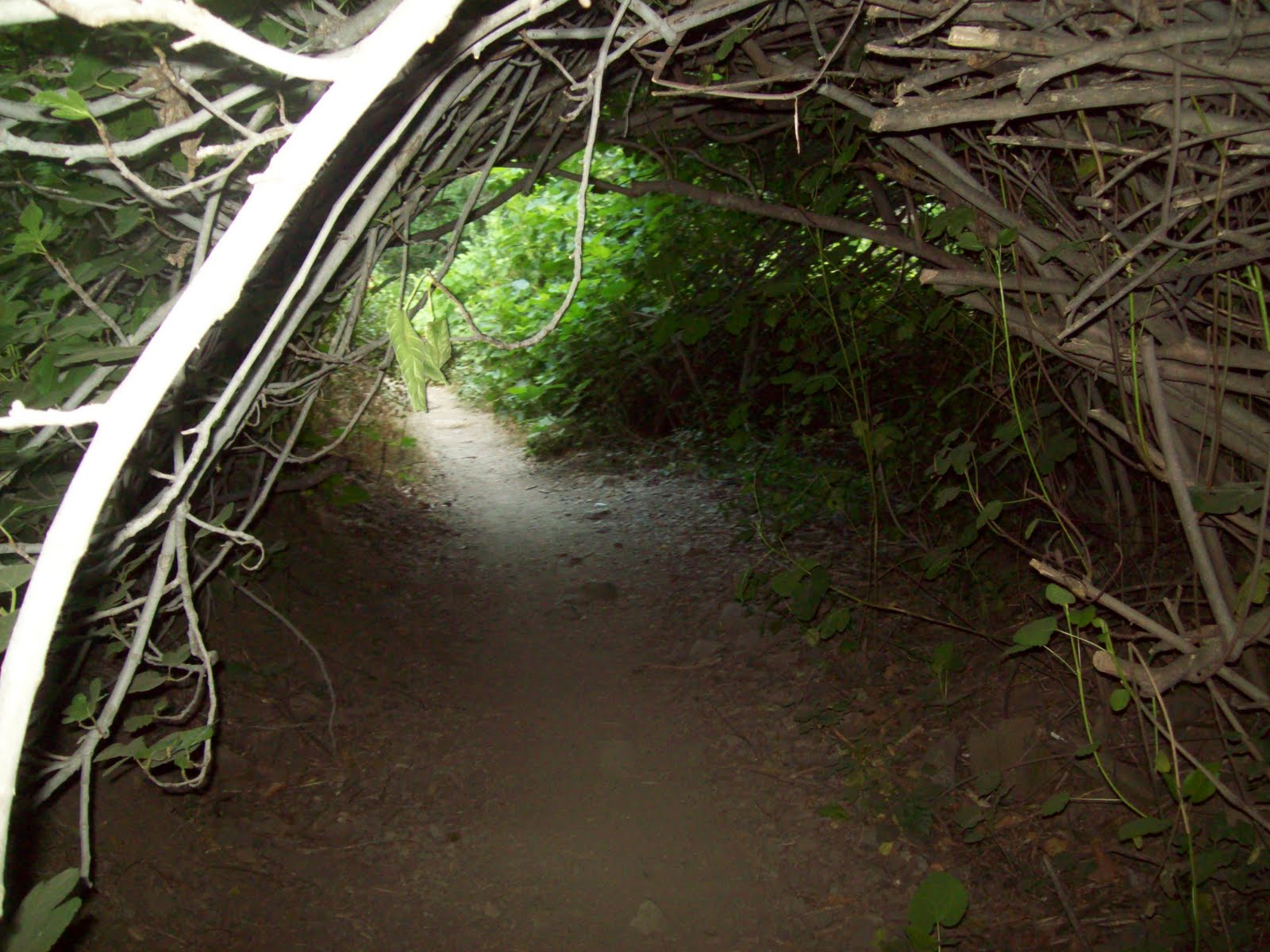
After gaining 1200 feet, I came to an overlook and a small tree in a planter. This marked the end of Hermit Gulch Trail and I crossed Divide Road and continued on to Lone Tree Trail. The trail flattened out for a minute then became a rollercoaster type trail that went up and over a bunch of small rounded summits. I just kept going over these hills and then the trail suddenly came to a dead end and a drop off to the backside of the island.  Walking to the edge of the cliff and looking at the turquoise water down below was pretty awesome. I had to be very careful since a slip here would not be a good thing especially since I was the only person out there.  I did see a few people on the trail on the way down but for the most part it seems that very few people come out this way.

It was now 1pm and my boat leaves at 3:45 so I figured that  I better  hustle it back down in order to make it in time.  I decided to take Divide Road back down and it's much faster and easier on the body than Hermit Gulch would have been.  I made it back to the dock by 3pm and had a nice boat ride back home.

This is a great day hike and while the first part of the hike is pretty tough, the reward is worth the effort


Hermit Gulch Trail
Lone Tree Point

Lone Tree Trail

Snaaaaakes!
Cactus flower


.


Wednesday, June 6, 2012

Mt. Islip review

On Sunday June 3rd we made a training hike to the top of Mt. Islip in the San Gabriel mountains. We got an early start to avoid the crowds that tend to invade Azusa Canyon during the summer.  The Crystal Lake Recreation Area had been closed for many years due to the 2002 Curve fire that destroyed much of the forest but it has all been rebuilt.  Everything except the small trading post is brand new and it's a great starting place for many hikes.

We chose to take the Windy Gap Trail that starts at 5700' and makes its way almost to the top before it intersects with the Pacific Crest Trail.  From there we took a slight detour to Little Jimmy Campground which is set along the north facing ridge overlooking the Mojave Desert.

After a short rest, we made our way along the Mt. Islip Ridge Trail to the summit at 8300'.  The summer haze made the visibility a bit poor but it was still nice to look out over the LA basin on one side and the desert to the other.  The four of us all made it to the top in good shape and stopped to sign the register and take a couple of photos. A few other hikers came up a few minutes behind us and took our picture and shared some strawberries with us...nice!

John, Casey, Jack & Victor
This is a great training hike for Mt. Langley and we plan to follow it up with a hike along the San Gabriel River to the Bridge to Nowhere in a couple of weeks.

Monday, May 28, 2012

Training for Mt. Langley

Well, it's been a while since I wrote anything about the Wolfpack Adventure Team but we do have a new adventure on the horizon.  On Labor Day this year we plan to be on the summit of Mt. Langley (14,049').

A few new members have joined the pack and we are beginning some of our training hikes in the local mountains.  James Brockway and Casey Ryan plan to join Jack Souders and myself as we work up to some higher elevation hiking.  Last year, my training on peaks like Baden-Powell (9,400') and San Gorgonio (11,500') really helped me to make the summit of Mt. Whitney (14,502') in September.

Our first test will be this coming weekend on Mt. Islip (8,250').

Monday, September 12, 2011

Mt. Baden-Powell Traverse

Mt. Baden-Powell
Elevation: 9399'
Distance: 9.2 miles
Total time: 4:45 minutes


Last Sunday, the Wolfpack consisted of just myself and Sean.  This hike required an early start and a bit of a drive out to the Wrightwood area.  We left one car at the Vincent Gap parking lot and drove to Dawson Saddle thereby making this a one way hike.  This way we were able to see more of the area without having to retrace our steps back down.


The trail is barely noticeable from the road but Sean's experience in the area got us on the trail and quickly ascending up the steep slope.  The incline was a bit tough this early in the morning but the trail soon leveled off giving me a chance to catch my breath.  We quickly joined the Pacific Crest Trail and made our way to Throop Peak at 9138'.  We signed the list of hikers and then made our way slightly downhill to Mt. Burnham at 8997'.  Next came a steady incline and strong cold winds that only added to my determination to make the summit of Baden-Powell.


After about an hour of climbing among thousand year old trees and looking out over the hazy Mojave Desert, we made our last push up to the summit.  The view from the top was awesome and this summit was a first for both Sean and I.  It's always strange to think that a population of over 10 million people are below you when you stand on a LA summit. We were the only people on top and we signed the register, had a bite to eat, and started our descent down the 40 plus switchbacks to Vincent Gap.  Making great time, we completed the 9.2 mile hike in under 5 hours. This being 9/11/2011, it made the hike a bit more special proving that terrorism will not stop Americans from enjoying our freedom.


Next up............11,500' San Gorgonio Mountain.


Saturday, July 30, 2011

Santa Anita Canyon Loop 7/30

Santa Anita Loop / Sturtevant Falls
Distance: 10 miles
Gain: 2100'
Time: 5 hours


Today, the Wolfpack consisted of John, Danny and Sean.  We decided to try out this 10 mile loop with the full packs we will using for Whitney.  This trail is crazy popular as it's an easy drive up the mountain to Chantry Flats.  We arrived around 8 am and the lot was already full and we had to park about 1/4 mile down the road.
The trail drops steeply down a paved road and it's a short hike along a flowing stream to the 50' Sturtevant Falls. We joined the crowd at the falls for a few minutes then proceeded up the Gabrielino Trail to the top of the falls and onto Spruce Grove Campground where we plan to return for an overnight trip to Mt. Wilson. We continued up the loop along the more exposed Mt. Zion Trail past the Zion summit at 3575' and then down the Winter Creek Trail back to the trailhead.
This is a beautifully shaded and peaceful trail and it passes many natural and man made small waterfalls  The only drawbacks are the crowds, poison oak is everywhere, and the trail can be a bit narrow with steep drop offs so you need to pay attention to where you step.  There is a great little area with tables, water and bbqs near the parking lot and there is a placed call The Deck serving sandwiches and drinks.  Were are looking forward to returning soon for the overnight trip.

Saturday, July 23, 2011

Santiago Success!

Santiago Peak
Elevation: 5687'
Distance: 16 miles RT
Gain: 4,000'
Time: 9 hours

Last weekend we decided that it was time to return to Mt. Santiago for some unfinished business.  Our last attempt at this peak was stopped short due to a heavy rain storm that made the trail nearly impossible.  Saturday's weather was much better and we were able to drive right to the trailhead at 1600'.
The Holy Jim Trail is now in excellent shape and goes by some small cabins, across Trabuco creek a number of times and goes through some really pretty scenery.  After about five miles, the trail comes out of the forest and climbs somewhat steeply up a fire road that is mostly exposed to the sun.  The last three miles seem to take a long time and we had to stop a few times for rest breaks but the summit was in view and we kept pressing on.  After about 5 1/2 hours of climbing, we made it to the summit which is an array of radio antennas.  The view was obscured by the haze and smog but it was nice to know that we made it to the top after seeing the summit almost everyday. We covered the 8 miles back down in about 3 1/2 hours so our total time time was 9 hours including about 30 minutes on the summit.  We are working well as a team and are looking forward to our next summit which will probably be Mt. Baldy in a few weeks.


Saturday, July 2, 2011

Sitton Peak 7/2/11

The original plan was to hike the beautifully shaded Santa Anita Trail in Arcadia but I found out the road was closed so I decided to do another hike up Sitton Peak.  Jack missed out on this one a few months ago so it was nice to be able to let him have a go at it.

We hit the trailhead at 8:15 am and made the 4.5 mile trip to the summit by 10:15.  There was just one couple signed in ahead of us and we met them on their way down.  The trail is in great shape and not too bad except the last push up to the summit where the heat was really starting to make things tough. We signed the log book, took a couple pics and then heard a rattlesnake right behind us though we never saw it.

Coming back, the heat was making the hike tougher than before but we pressed on.  We missed our turn near the bottom which added about another 20 minutes of uphill climbing with no water. Got back to the parking lot around 1pm and hit the refreshing cold water pump. Temperature gauge in the car read 100 F...yikes!
 This is a great day hike that most people should be able to do with the right preparation.