Monday, September 12, 2011

Mt. Baden-Powell Traverse

Mt. Baden-Powell
Elevation: 9399'
Distance: 9.2 miles
Total time: 4:45 minutes


Last Sunday, the Wolfpack consisted of just myself and Sean.  This hike required an early start and a bit of a drive out to the Wrightwood area.  We left one car at the Vincent Gap parking lot and drove to Dawson Saddle thereby making this a one way hike.  This way we were able to see more of the area without having to retrace our steps back down.


The trail is barely noticeable from the road but Sean's experience in the area got us on the trail and quickly ascending up the steep slope.  The incline was a bit tough this early in the morning but the trail soon leveled off giving me a chance to catch my breath.  We quickly joined the Pacific Crest Trail and made our way to Throop Peak at 9138'.  We signed the list of hikers and then made our way slightly downhill to Mt. Burnham at 8997'.  Next came a steady incline and strong cold winds that only added to my determination to make the summit of Baden-Powell.


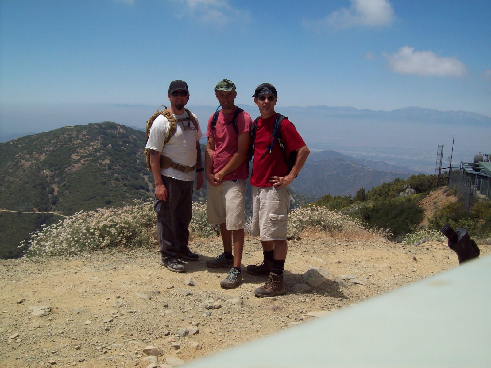
After about an hour of climbing among thousand year old trees and looking out over the hazy Mojave Desert, we made our last push up to the summit.  The view from the top was awesome and this summit was a first for both Sean and I.  It's always strange to think that a population of over 10 million people are below you when you stand on a LA summit. We were the only people on top and we signed the register, had a bite to eat, and started our descent down the 40 plus switchbacks to Vincent Gap.  Making great time, we completed the 9.2 mile hike in under 5 hours. This being 9/11/2011, it made the hike a bit more special proving that terrorism will not stop Americans from enjoying our freedom.


Next up............11,500' San Gorgonio Mountain.


Saturday, July 30, 2011

Santa Anita Canyon Loop 7/30

Santa Anita Loop / Sturtevant Falls
Distance: 10 miles
Gain: 2100'
Time: 5 hours


Today, the Wolfpack consisted of John, Danny and Sean.  We decided to try out this 10 mile loop with the full packs we will using for Whitney.  This trail is crazy popular as it's an easy drive up the mountain to Chantry Flats.  We arrived around 8 am and the lot was already full and we had to park about 1/4 mile down the road.
The trail drops steeply down a paved road and it's a short hike along a flowing stream to the 50' Sturtevant Falls. We joined the crowd at the falls for a few minutes then proceeded up the Gabrielino Trail to the top of the falls and onto Spruce Grove Campground where we plan to return for an overnight trip to Mt. Wilson. We continued up the loop along the more exposed Mt. Zion Trail past the Zion summit at 3575' and then down the Winter Creek Trail back to the trailhead.
This is a beautifully shaded and peaceful trail and it passes many natural and man made small waterfalls  The only drawbacks are the crowds, poison oak is everywhere, and the trail can be a bit narrow with steep drop offs so you need to pay attention to where you step.  There is a great little area with tables, water and bbqs near the parking lot and there is a placed call The Deck serving sandwiches and drinks.  Were are looking forward to returning soon for the overnight trip.

Saturday, July 23, 2011

Santiago Success!

Santiago Peak
Elevation: 5687'
Distance: 16 miles RT
Gain: 4,000'
Time: 9 hours

Last weekend we decided that it was time to return to Mt. Santiago for some unfinished business.  Our last attempt at this peak was stopped short due to a heavy rain storm that made the trail nearly impossible.  Saturday's weather was much better and we were able to drive right to the trailhead at 1600'.
The Holy Jim Trail is now in excellent shape and goes by some small cabins, across Trabuco creek a number of times and goes through some really pretty scenery.  After about five miles, the trail comes out of the forest and climbs somewhat steeply up a fire road that is mostly exposed to the sun.  The last three miles seem to take a long time and we had to stop a few times for rest breaks but the summit was in view and we kept pressing on.  After about 5 1/2 hours of climbing, we made it to the summit which is an array of radio antennas.  The view was obscured by the haze and smog but it was nice to know that we made it to the top after seeing the summit almost everyday. We covered the 8 miles back down in about 3 1/2 hours so our total time time was 9 hours including about 30 minutes on the summit.  We are working well as a team and are looking forward to our next summit which will probably be Mt. Baldy in a few weeks.


Saturday, July 2, 2011

Sitton Peak 7/2/11

The original plan was to hike the beautifully shaded Santa Anita Trail in Arcadia but I found out the road was closed so I decided to do another hike up Sitton Peak.  Jack missed out on this one a few months ago so it was nice to be able to let him have a go at it.

We hit the trailhead at 8:15 am and made the 4.5 mile trip to the summit by 10:15.  There was just one couple signed in ahead of us and we met them on their way down.  The trail is in great shape and not too bad except the last push up to the summit where the heat was really starting to make things tough. We signed the log book, took a couple pics and then heard a rattlesnake right behind us though we never saw it.

Coming back, the heat was making the hike tougher than before but we pressed on.  We missed our turn near the bottom which added about another 20 minutes of uphill climbing with no water. Got back to the parking lot around 1pm and hit the refreshing cold water pump. Temperature gauge in the car read 100 F...yikes!
 This is a great day hike that most people should be able to do with the right preparation.

Saturday, June 18, 2011

Iron Mountain 2nd try

Today we gave Iron Mountain another try.
Team members John, Danny and Jack hit the trailhead (2030') at 7am and we moved quickly up the steep trail.  We stashed our extra water and gear at the first saddle about an hour later at 3042'.   We pressed on through the cloud cover and up and down a few ridges until we stopped for a break at a small fire pit that someone made.  This put us at about 4600' and from there the trail rarely gave us a minute of relief from the uphill ascent.  The sun came out and so did the relentless flies that stayed with us the rest of the trip up.  At about 6000', the trail turns more into rock climbing than hiking for the remaining 2000 feet to the summit. This meant a few steps at a time for another two hours with biting flies and a hot sun so we decided to throw in the towel and turn around. We would have really liked to have made the summit especially with it less than 2 miles away but a 4500' gain in about 4 hours is pretty respectable.  Coming down meant having to butt slide every once in a while but we made it down quickly and enjoyed a nice cold foot bath in the San Gabriel River at the end of the trail.
There won't be a third attempt on this mountain.


Jack took a bunch of pics and I will post them later.

Sunday, May 15, 2011

Iron Mountain attempt 5/15/11

Iron Mountain
San Gabriel Mountains
Elevation: 8007'
Distance: 15 miles
Gain: 7200'


According to John Robinson, author of Trails of the Angeles, "8007 foot Iron Mountain is by far the least accessible peak in the San Gabriels....No trail approaches its isolated summit , and to climb it you must start miles away and thousands of feet below." In this local hiking legend's view, "Big Iron" is the most strenuous one-summit hike in the entire San Gabriel range.


We got an early start and had a good plan but mother nature had another idea.  After changing a flat tire on my car we made the steep ascent at a good pace.  The first part is pretty tough for a newbie like me but the light drizzle kept us cool.  The drizzle never let up though and soon became rain that stayed steady up to the 3000' mark and only got worse.  After a while the conditions were becoming a bit miserable and we decided to turn around and save this for another day.  This is an extreme hike that should not be taken lightly.  Preparation, good shoes, and plenty of water seem to be the rule for this beast.


We plan to try this again next weekend and hope for a successful summit.

Sunday, May 8, 2011

Snowmobile crash.

Ouch!  This is why you should carry an ice axe. Make it stop already!

Saturday, May 7, 2011

Mt. Whitney video

Check out this great video of the hike up Mt. Whitney. (not us, yet)

Tuesday, April 12, 2011

Training hikes

List of  peaks we would like to bag before Whitney.


Sitton: 3,273'  Gain: 2150' (done 1/25)


Santiago: 5,694'


Baden-Powell: 9,399'


Baldy: 10,064'


San Jacinto: 10,834'


San Gorgonio: 11,503'


Whitney: 14, 505'

Thursday, April 7, 2011

Mt. Whitney here we come!

So we were successful in the Mt. Whitney lottery!  We were given the dates of September 28-29 for our summit bid.  Now all we have to secure the days off with work and step up our training hikes.  Our last trip to Mt. Wilson was cancelled due to a back injury but Danny and Jack were able to do a hike in Laguna Canyon.  We will be doing the Wilson hike sometime in the next few weeks.  Report and photos to follow so stay posted

Sunday, March 13, 2011

Next hike, Mt. Wilson.

Our next hike will be this Saturday to the summit of Mt. Wilson (5,700'). Review to follow, wish us luck.

Sunday, February 6, 2011

Sitton Peak review 2/6/2011


John and Danny at the summit of Sitton Peak 2/6/2011


Sitton Peak
Santa Ana Mountains
Elevation: 3273'
9.5 miles round trip
Gain/ Loss 2150'
Our time to summit: 2 hr 28 min
Total time: 4 hr 52 min

Today the Wolfpack consisted of  just John and Danny and we decided to seize the day and attempt the summit of Sitton Peak. The weather was perfect and the trail was empty probably because it was Super Bowl Sunday. After signing in at the trailhead, we started our ascent along a well maintain single file trail.  The trail is a bit steep for the first mile and really gets the blood pumping but it's nothing too crazy. The trail is a mix of shade and open space and could be pretty tough on a hot day. We saw a snake, the remains of an old plane crash, and a lot of horse poop. There's one short section that is flat but it's mostly a moderate ascent until you get near the summit. From there it's mostly bushwhacking it one step at a time.  After  about 2 1/2 hours, we were on the summit and the view was awesome. We could see downtown LA and even San Clemente Island some 70 miles away, totally worth the effort. Coming down can be a bit treacherous as I slipped twice and even broke my trusty walking stick, bummer. Good shoes with plenty of traction is a must as there are spots of small rocks and sandy boulders. Also, there is no water source along the trail so bring plenty. There is a hand pump water well at the parking lot for a nice splash at the end of the day.  I recommend this hike to anyone in reasonable physical shape.
PS, the trail is also dog friendly and does not allow mountain bikers.
Danny at summit


View looking towards Los Angeles
Summit marker at 3273'

Thursday, January 27, 2011

Next Hike

Our next hike will be this Sunday morning to Sitton Peak. Team members John, Jack, Danny, and Wendy will be attempting the summit.  Review to follow.

Wednesday, January 19, 2011

Mt. Whitney application

Well, the Mt. Whitney trail allows only 60 people per day to hike overnight.  So you have to apply to the "lottery" in hopes that you will secure one of the spots.  The application is filled out, the dates are picked (any date is ok for us), and the check is written. Now all we have to do is wait until February 1st and mail it off.  Wish us luck, we will be training hard in the next couple of weeks.

Sunday, January 2, 2011

12/31/10 Attempted Mt. Santiago Peak

Mt. Santiago Peak
Elevation: 5687'
15.0 miles round trip
Gain/Loss: 3950'/3950'
Difficulty: 4 out of 5 stars

Last Friday was the last day of the year and we decided to start our training with a hike to the summit of Mt. Santiago in the Cleveland National Forest. Team members Danny Chesley, Jack Souders, and myself headed out early for the 15 mile round trip hike. Mother nature had different plans as the road to the trailhead was in horrible shape due to the recent heavy rains. We hoped to make the summit in about three hours and another 2 1/2 to return. But after traversing the swollen Trabuco Creek numerous times, we realized that conditions just didn't favor us today. Past the Holy Jim cabin we decided that we were running out of time and had to head back. On the way down, we met a resident who warned us of a hungry male mountain lion that had been seen in the area. I don't know about you, but being lunch for a wild animal is not the way I want to go. All in all, the Holy Jim trail is a beautiful hike and I have to remember that experience is what you get when you don't get what you wanted. We plan on making another attempt at this summit when conditions improve. In the mean time, our next hike is being planned and I will post a review along with some pics.

Introducing my new blog


Welcome to the Wolfpack Adventure Team's blogspot. We are a small group of friends who have decided to climb to the summit of the highest peak in the continental United States. Mt. Whitney in Northern California is our goal this summer and we will be doing training hikes in preparation. This blog is just a fun way to share our photos and adventures and to keep track of our progress.

Feel free to chime in with any comments or suggestions. We're by no means professional adventure seekers, just a couple of dudes who share a few things in common.

"It's supposed to be hard, if it wasn't hard everyone would do it. It's the hard that makes it great"
Tom Hanks in A League of Their Own