Saturday, July 30, 2011

Santa Anita Canyon Loop 7/30

Santa Anita Loop / Sturtevant Falls
Distance: 10 miles
Gain: 2100'
Time: 5 hours


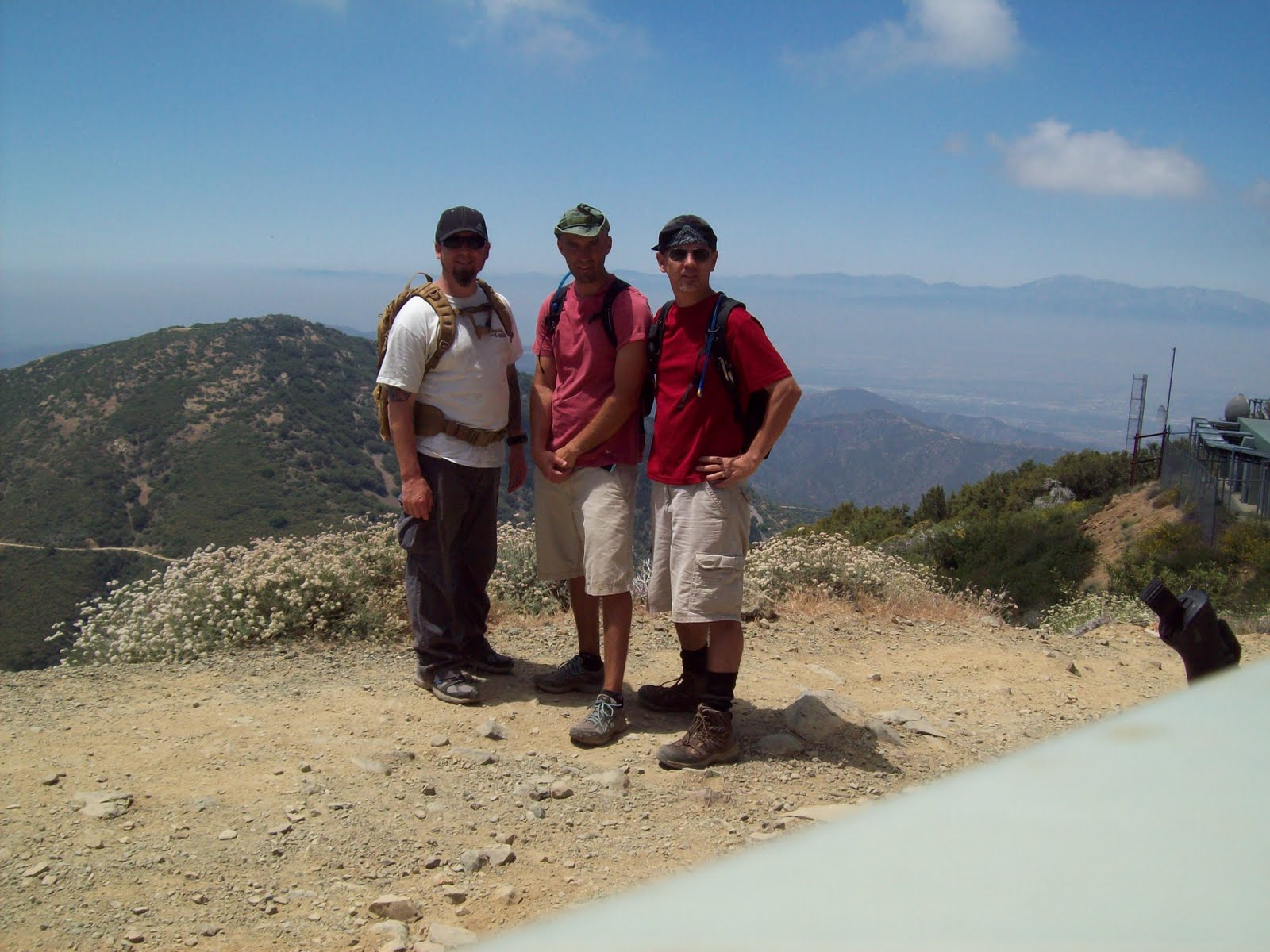
Today, the Wolfpack consisted of John, Danny and Sean.  We decided to try out this 10 mile loop with the full packs we will using for Whitney.  This trail is crazy popular as it's an easy drive up the mountain to Chantry Flats.  We arrived around 8 am and the lot was already full and we had to park about 1/4 mile down the road.
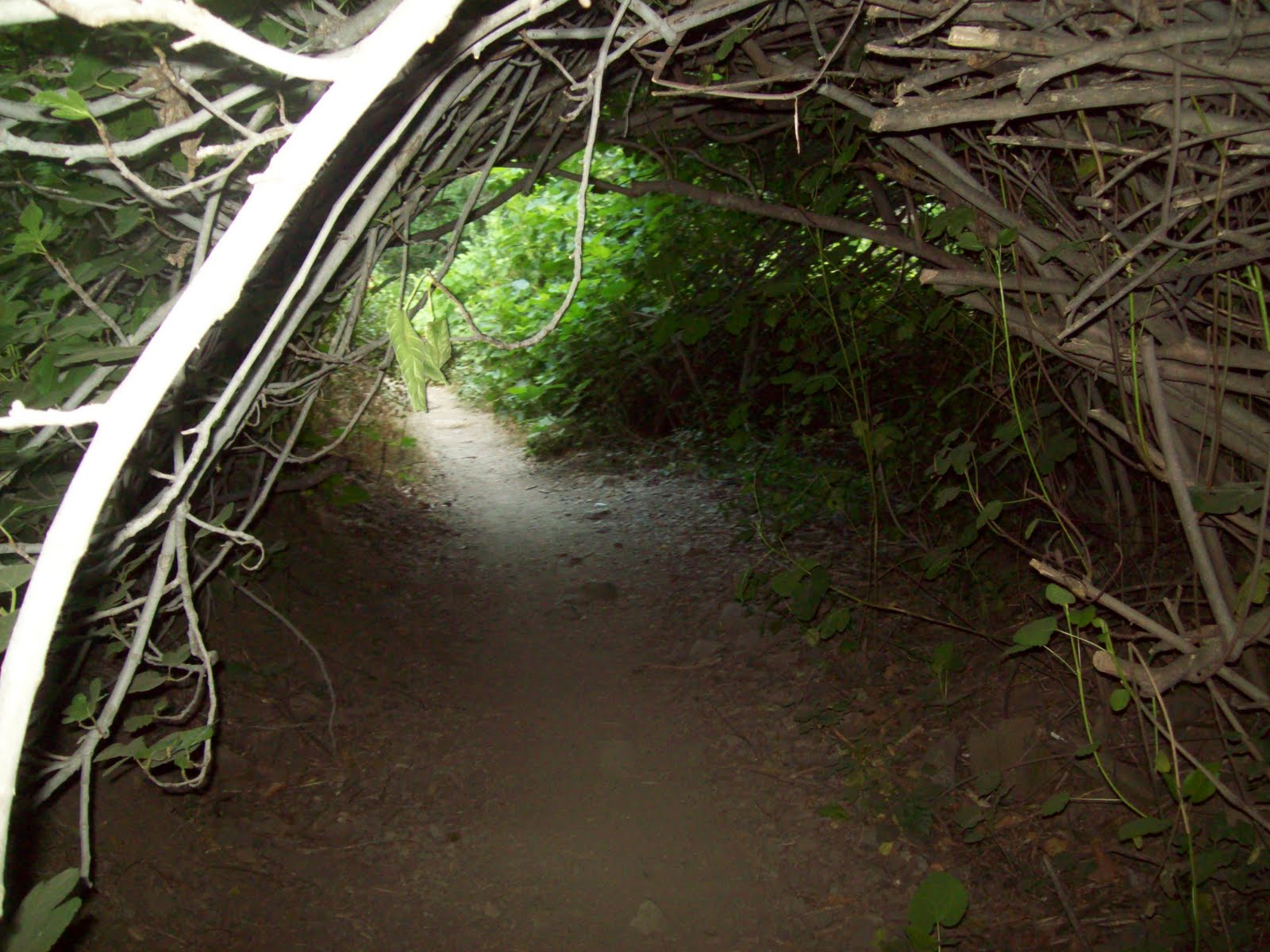
The trail drops steeply down a paved road and it's a short hike along a flowing stream to the 50' Sturtevant Falls. We joined the crowd at the falls for a few minutes then proceeded up the Gabrielino Trail to the top of the falls and onto Spruce Grove Campground where we plan to return for an overnight trip to Mt. Wilson. We continued up the loop along the more exposed Mt. Zion Trail past the Zion summit at 3575' and then down the Winter Creek Trail back to the trailhead.
This is a beautifully shaded and peaceful trail and it passes many natural and man made small waterfalls  The only drawbacks are the crowds, poison oak is everywhere, and the trail can be a bit narrow with steep drop offs so you need to pay attention to where you step.  There is a great little area with tables, water and bbqs near the parking lot and there is a placed call The Deck serving sandwiches and drinks.  Were are looking forward to returning soon for the overnight trip.

Saturday, July 23, 2011

Santiago Success!

Santiago Peak
Elevation: 5687'
Distance: 16 miles RT
Gain: 4,000'
Time: 9 hours

Last weekend we decided that it was time to return to Mt. Santiago for some unfinished business.  Our last attempt at this peak was stopped short due to a heavy rain storm that made the trail nearly impossible.  Saturday's weather was much better and we were able to drive right to the trailhead at 1600'.
The Holy Jim Trail is now in excellent shape and goes by some small cabins, across Trabuco creek a number of times and goes through some really pretty scenery.  After about five miles, the trail comes out of the forest and climbs somewhat steeply up a fire road that is mostly exposed to the sun.  The last three miles seem to take a long time and we had to stop a few times for rest breaks but the summit was in view and we kept pressing on.  After about 5 1/2 hours of climbing, we made it to the summit which is an array of radio antennas.  The view was obscured by the haze and smog but it was nice to know that we made it to the top after seeing the summit almost everyday. We covered the 8 miles back down in about 3 1/2 hours so our total time time was 9 hours including about 30 minutes on the summit.  We are working well as a team and are looking forward to our next summit which will probably be Mt. Baldy in a few weeks.


Saturday, July 2, 2011

Sitton Peak 7/2/11

The original plan was to hike the beautifully shaded Santa Anita Trail in Arcadia but I found out the road was closed so I decided to do another hike up Sitton Peak.  Jack missed out on this one a few months ago so it was nice to be able to let him have a go at it.

We hit the trailhead at 8:15 am and made the 4.5 mile trip to the summit by 10:15.  There was just one couple signed in ahead of us and we met them on their way down.  The trail is in great shape and not too bad except the last push up to the summit where the heat was really starting to make things tough. We signed the log book, took a couple pics and then heard a rattlesnake right behind us though we never saw it.

Coming back, the heat was making the hike tougher than before but we pressed on.  We missed our turn near the bottom which added about another 20 minutes of uphill climbing with no water. Got back to the parking lot around 1pm and hit the refreshing cold water pump. Temperature gauge in the car read 100 F...yikes!
 This is a great day hike that most people should be able to do with the right preparation.